What Urban America Can Learn From Mexico City’s Best Areas
Well-designed City Streets Improve Neighborhood Value. Why Don’t More U.S. Cities Create Them?
For the past week I’ve vacationed in Mexico City, the largest metropolis in the Americas and one I had yet to visit. It’s a great place for students of cities, especially those who want to bring ideas back to the U.S. Ciudad de Mexico as it is now known (or CDMX) has beautiful historic architecture; a well-functioning transit system (both public and private); and a massive ecosystem of ground-level commerce. But I was most impressed by their street design, and what it tells us about economic development.
Much of my time over the week was spent in three of CDMX’s best neighborhoods—Polanco, Roma, and Condesa. All three have histories of housing the Mexican business elite, and continue to be luxury areas, as much a destination for trendy internationals as locals. One thing they have in common is a street design motif that’s incredible, nay, unrivaled by any U.S. city.
For example Condesa, where I stayed, largely grew in the late 19th and early 20th centuries, when it was a suburb for the political allies of president Porfirio Diaz. It was planned to include grand boulevards, wide sidewalks, tree-lined medians and lush parks, big and small. Further public and private investment through the decades has led to crosswalk murals; benches wrapped in bushes; short pedestrian malls; and sidewalks that have extended built-in plant and flower beds. The private homes, many of them Spanish Colonial Revival, have been well-maintained and often feature hanging gardens and vegetation built into the façade.

All this makes Condesa feel like some combination of a tropical paradise and urban design bonanza, and Roma and Polanco are the same way. Their attractiveness has lured investment: of CDMX’s hundreds of neighborhoods, Polanco is the most expensive, while Condesa and Roma are in the top 10.

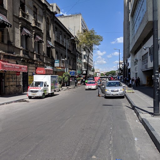
But once I left those nice neighborhoods and entered CDMX’s standard barrios, such as the big commercial markets near downtown, I found that these features disappeared. There was little to no green space and poor sanitation. Roads served as traffic sewers, which made them look and smell polluted from all the car exhaust.
I’ve noticed this discrepancy in the U.S. also. The common features, for example, in nice New York City neighborhoods like Park Slope and the Upper West Side include wide sidewalks, tasteful medians, and abundant tree cover. Poorer areas in The Bronx, Queens and upper Manhattan generally don’t have such attractive streetscapes.
This shows a fundamental insight—and one not well-embraced by America’s economic development community—about what actually creates valuable neighborhoods. The folk wisdom is that they are either “good” or “bad” based on their location, housing stock, and people. The attractiveness of the urban realm and the streetscapes is an under-appreciated factor. But there’s significant literature showing that this matters. Different studies that analyzed New York City, Austin, and Belfast, respectively, found that proximity to green space increased home and property values. Other studies show that “complete streets” (the name used to describe streets with the above-mentioned design features) perform better economically.
Yet U.S. cities don’t view street design in explicit dollars-and-cents terms. While there are high-income neighborhoods that have pleasant streets (Boston’s Back Bay and Washington, DC’s Georgetown also jump to mind), there are vastly more that ignore this value-add tool. Take the prominent streets in most downtown areas: they’re often traffic sewers that are used for the parking and throughput of automobiles, precisely because downtown business interests want the streets used for that. It doesn’t occur to them that if streets were retrofitted for placemaking, it would better serve the businesses’ bottom lines. Inbound traffic may move a little slower, but patrons are getting to access a much nicer area. As it happens now, spatial priorities in most downtowns are delineated the same way they are on Manhattan’s Avenue of the Americas. That thoroughfare dedicates 6 lanes to one-way car and bus traffic. It uses far less space for the many pedestrians who use the street, and practically none for greenspace. This is a missed opportunity to improve that area for shoppers who patronize its high-end stores. Which is to say: it’s a design flaw that potentially strips the city of higher property values and tax revenues.

Like New York City, other U.S. cities should reconsider their pro-car street design strategy, particularly in the densest, most in-demand areas. As Mexico City shows, adding pedestrian infrastructure and green space not only makes urban areas more valuable. It also makes them more pleasant places to be.